Your widgets
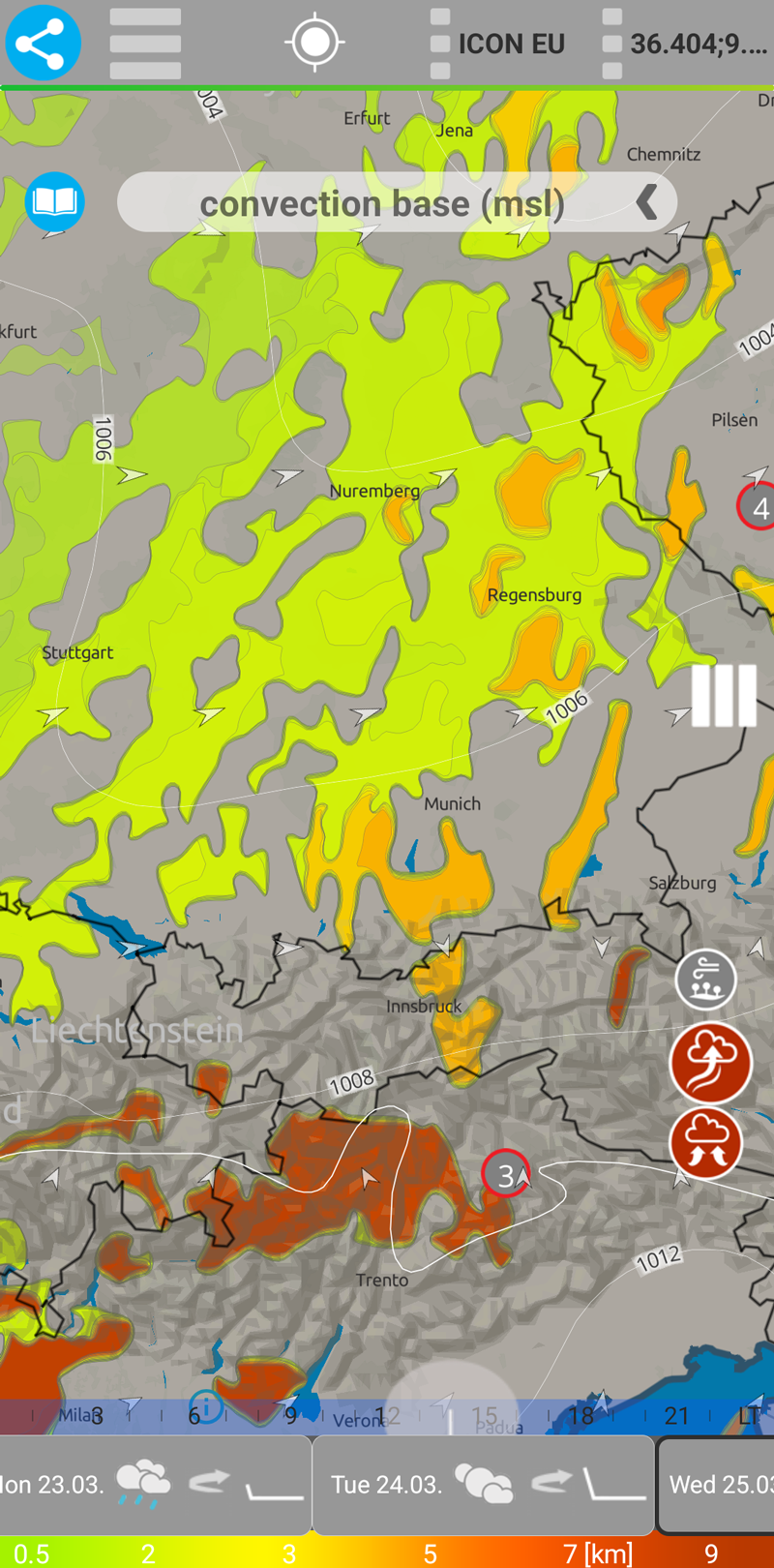
Convection base map
TQuick summary The Convection base map shows at what altitude (MSL) the model diagnoses the start of a convective layer / convective cells. It is not the same as “the lowest cloud” and it is not necessarily an exact “cloud base” — convection can occur within existing cloudiness or in a higher layer.
More detailed explanation
Convection is the vertical motion of air (updrafts and downdrafts), most often driven by heating of the Earth’s surface. The convection base parameter describes the altitude where the model expects the convective process to begin to appear as a distinct convective layer (typically associated with convective cloudiness within the model).
Therefore, convection base does not say “where all cloudiness begins,” but rather “where the model sees the start of convection.” Why it can differ from the cloud base
Low cloudiness can be stratiform (stratus/stratocumulus) and its base may lie lower than the convection base value. In such cases, convection may occur: within a low cloud deck (convective cells inside stratocumulus), or higher in a layer (embedded/elevated convection within mid-level cloudiness). That is why the convection base can sometimes lie “in the middle” of low or mid-level cloudiness.
How to read the map (pilot view)
Lower convection base values often correspond to situations where convection is closer to the ground — more often a classic thermal regime (sometimes a cumulus day if updrafts reach saturation). Higher convection base values more often indicate convection in a layer (elevated/embedded). This does not necessarily mean good thermals from the ground — it often means a “livelier” atmosphere aloft, while near the surface thermals may be weaker or suppressed (for example due to cloud shading). Important note about altitude
The value is in MSL (above mean sea level). For practical flying it is useful to consider altitude above ground (AGL) as well: AGL ≈ convection base − terrain elevation. In the mountains, convection base in MSL can be high, but the height above the terrain may be significantly lower. Tip: interpret together with other layers
If convection base is close to KKH/CCL and there is no closed low cloud deck, it often indicates a “cleaner” thermal regime. If convection base is well above KKH and mid-level cloudiness is present, it more often indicates convection in a layer — for paragliding this is often less reliable than a classic cumulus day.