The application can display several high levels. The levels were chosen with regard to use for flying at lower altitudes of approx. 0...3500 m. All base levels are the same for wind, temperature, and relative humidity. The following levels are available in version 7.xxxx:
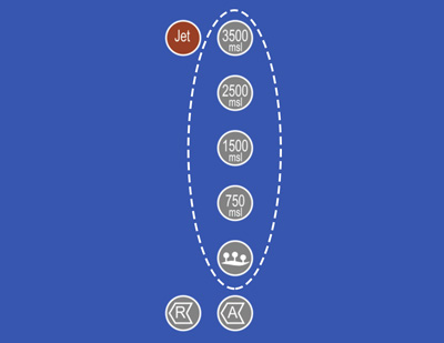
level 3500 meters height above sea level ("MSL")
level 2500 meters height above sea level ("MSL")
level 1500 meters height above sea level ("MSL")
level 750 meters height above sea level ("MSL")
level at the ground
For wind it is 10 meters above the ground.
For temperature and humidity 2 meters above the ground.
For temperature and humidity 2 meters above the ground.
In meteorology, "MSL" stands for Mean Sea Level. It refers to the height or elevation above sea level. MSL is a standardized reference level used to express heights and elevations in meteorological and geographic measurements.
MSL is used to determine the elevation of points relative to sea level and to ensure measurement consistency across different locations. Meteorological data such as pressure, temperature, or cloud height are often reported in relation to MSL.
By using MSL, the differences in elevations between different areas are overcome, allowing for the comparison of meteorological data and their interpretation on a global scale.