How to do it
Select the main map icon for instability. You will see a color map of the height of the maximum unstable stratification in the range of 0..6000 m above sea level.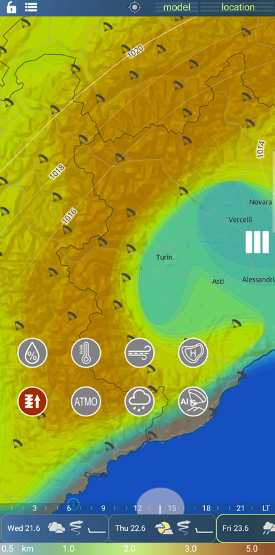
How does atmospheric instability affect thermal flight?
Atmospheric instability has a significant influence on thermal soaring. Here's how instability affects thermal gliding:
Formation of Thermals: Atmospheric instability creates favorable conditions for the formation of thermals. When the atmosphere is unstable, parcels of air near the Earth's surface can rise rapidly due to buoyancy forces. This upward movement of air forms thermals, which are columns of warm, rising air. Glider pilots rely on these thermals to gain altitude and sustain their flights.
Stronger Updrafts: In an unstable atmosphere, the vertical movement of air is enhanced. Updrafts within thermals become stronger and more vigorous, providing glider pilots with powerful lift forces. These strong updrafts enable pilots to climb at a higher rate and reach greater altitudes, extending their flight durations.
Increased Vertical Motion: Instability in the atmosphere promotes increased vertical motion, including the formation of cumulus clouds and convective activity. Cumulus clouds are often associated with rising air and thermal development. Glider pilots can use the visual cues provided by these clouds to locate areas of strong lift and exploit them for optimal soaring conditions.
Greater Variability: Instability can introduce greater variability in thermal conditions. Thermals may form in different locations, exhibit varying strengths, and have uneven distributions. This variability poses both challenges and opportunities for glider pilots, as they need to navigate and adapt to changing thermal patterns during their flights.
Potential for Thunderstorm Development: In extreme cases, atmospheric instability can lead to the development of thunderstorms. Thunderstorms are characterized by powerful updrafts, downdrafts, and turbulent conditions. It is crucial for glider pilots to avoid flying near or within thunderstorms due to the associated hazards, including severe turbulence, lightning, and strong winds.
In summary, atmospheric instability promotes the formation of thermals, enhances updraft strength, and increases vertical motion in the atmosphere. Glider pilots rely on these unstable conditions to exploit rising air and achieve optimal thermal soaring during their flights. However, they must also be aware of the risks associated with severe instability, such as thunderstorm development, and exercise caution when planning their flights.
How does atmospheric instability occur?
Atmospheric instability arises from various factors and processes. Here's an explanation of how atmospheric instability is generated:
Differential Heating: Differential heating occurs when different regions of the Earth's surface receive unequal amounts of solar radiation. For example, land surfaces tend to heat up more quickly than water surfaces. This uneven heating leads to temperature variations in the lower atmosphere, creating a potential for instability.
Adiabatic Processes: As air rises or sinks in the atmosphere, it undergoes adiabatic processes that affect its temperature and density. When an air parcel rises, it expands due to decreasing atmospheric pressure, which leads to adiabatic cooling. On the other hand, a descending air parcel experiences adiabatic compression, resulting in warming. These vertical temperature changes can contribute to atmospheric instability.
Moisture and Condensation: The presence of moisture in the atmosphere can play a role in generating instability. Moist air tends to be less dense than dry air, and as moist air rises, it cools. When the temperature drops below the dew point, water vapor condenses, releasing latent heat into the surrounding air. This process, known as latent heat release, further enhances the upward motion and instability.
Lapse Rate: The lapse rate refers to the rate at which temperature changes with height in the atmosphere. A steep lapse rate, where temperature decreases rapidly with increasing altitude, can indicate instability. This condition allows parcels of air to rise freely and initiate convective processes, leading to the formation of clouds and vertical motion.
Frontal Systems: Frontal boundaries, such as cold fronts and warm fronts, can trigger atmospheric instability. When two air masses with different characteristics (temperature, moisture content) collide along a front, it can lead to the lifting of air, cloud formation, and the potential for thunderstorm development.
Orographic Lifting: When air encounters a mountain or elevated terrain, it is forced to rise. As the air rises, it cools adiabatically, potentially leading to instability and the formation of clouds and precipitation on the windward side of the mountains.
These processes and factors can interact and contribute to the development of atmospheric instability. The resulting unstable conditions promote vertical motion, convective processes, and the formation of clouds, leading to phenomena such as thunderstorms, cumulus clouds, and turbulent weather patterns.
The Earth's surface plays a significant role in influencing the development of atmospheric instability.
Here are some examples of different types of terrain and how they can contribute to instability:
Mountains: Mountainous regions can induce atmospheric instability through orographic lifting. As air encounters a mountain, it is forced to rise, leading to adiabatic cooling and the potential for cloud formation and precipitation on the windward side of the mountains. This lifting mechanism can enhance vertical motion and the development of unstable atmospheric conditions.
Coastlines: Coastal areas can experience instability due to the differential heating between land and water surfaces. During the day, land surfaces heat up more quickly than water surfaces, leading to the formation of a sea breeze. The contrasting air masses can collide, resulting in lifting and the potential for convective processes and thunderstorm development.
Plains and Plateaus: Flat or gently sloping terrains, such as plains and plateaus, can contribute to instability through surface heating. These areas can experience strong solar heating, especially during hot and dry conditions. The intense surface heating can lead to the formation of thermals, which are parcels of warm air that rise rapidly and trigger convective processes.
Urban Areas: Urban environments with extensive concrete and asphalt surfaces can generate what is known as the urban heat island effect. Urban areas tend to retain heat, causing local temperature increases compared to surrounding rural areas. The increased surface temperatures can create localized instability, leading to the development of convective processes and the formation of urban thunderstorms.
Vegetated Areas: Regions with dense vegetation, such as forests, can influence instability through evapotranspiration. Vegetation releases moisture into the atmosphere through transpiration, which can increase atmospheric moisture content. The presence of moisture can contribute to instability and the formation of convective clouds under favorable conditions.
Tillage Soil: Tillage of the soil can lead to changes in the surface characteristics, particularly in large agricultural areas. The tilled soil may have different thermal properties compared to untilled soil.These changes can impact thermal soaring by influencing the behavior of air masses and their ability to generate updrafts.
Soil After Rain: Soil saturated with rainwater can have higher moisture content. Moist soil can absorb solar energy and help create thermal updrafts. The presence of moist soil can enhance thermal soaring by providing a source of heat and moisture, which promotes the formation of rising air currents.
Snow-Covered Soil: Snow-covered soil reflects a significant amount of incoming solar radiation, reducing the amount of heat absorbed by the ground. This can result in cooler surface temperatures and less thermal activity. However, the melting of snow can lead to increased soil moisture, which can contribute to thermal soaring once the ground is exposed.
These are just a few examples of how different types of terrain can influence atmospheric instability. The specific characteristics of the terrain, such as elevation, surface type, and land-sea interactions, interact with meteorological factors to shape local weather patterns and the potential for convective activity.